Introduction
Reaching the Lofoten Islands is rarely a single, straightforward step. The journey usually involves a combination of flights, roads, ferries, and long coastal stretches that take longer than the map suggests. That complexity is part of what makes Lofoten feel distinct, but it also means that transport decisions can shape the entire trip.
How you arrive, where you enter the islands, and how you plan to move between places all affect what you can realistically see and do. Distances are not large, but weather plays a constant role, and travel often takes longer than expected. Some routes prioritize efficiency, others the experience. Neither is objectively better, but they lead to very different stays.
This article focuses on the practical side of traveling to and within the Lofoten Islands. Not as a checklist, but as a way to understand how geography, infrastructure, and season influence movement. The aim is to help make sense of the options before planning activities or committing to a route, whether that means flying in, driving up from the mainland, or combining several modes of transport.
The sections below follow the natural order of a trip: where Lofoten is located, how people usually get there, how transport works once on the islands, and how those choices affect the rhythm of a stay.
Where Are the Lofoten Islands?

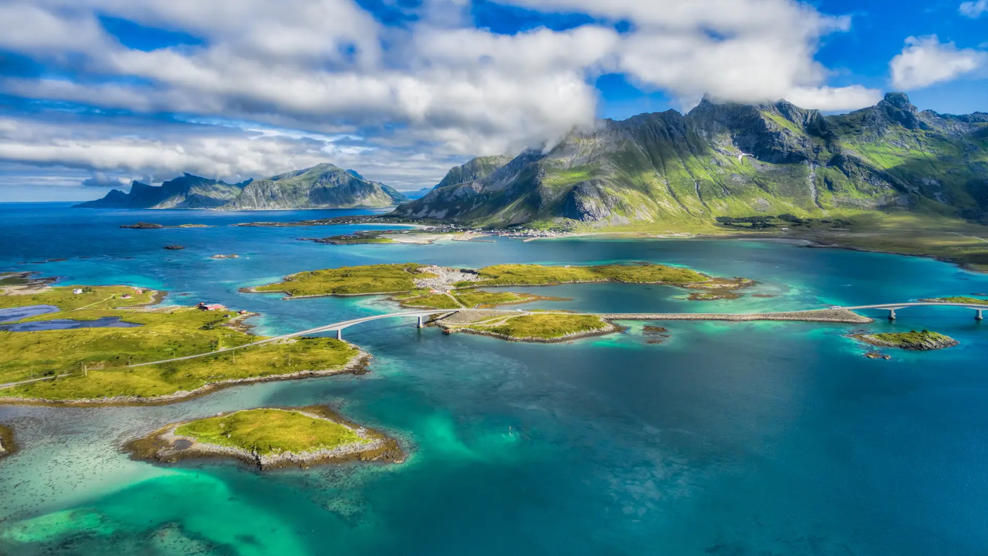
The Lofoten Islands form a long, narrow archipelago off the coast of northern Norway, stretching into the Norwegian Sea above the Arctic Circle. From a distance, they appear compact, but in practice, the islands are spread out along a winding axis of mountains, bridges, and fjords. There is no single entry point, and no central hub that everything revolves around.
What matters most about Lofoten’s location is not just how far north it lies, but how it connects, or does not connect, to the surrounding mainland. Roads become narrower, weather plays a larger role, and travel options become more limited the further north you go. This isolation is part of the appeal, but it comes with practical consequences.
Movement in Lofoten happens largely along one main route that links the islands from northeast to southwest. While distances between villages or trailheads may look short, the combination of terrain, speed limits, and traffic often stretches travel time. A drive of 40 or 50 kilometers can easily take over an hour, especially during busy summer days or unstable weather.
The geography also explains why travel planning in Lofoten is less about ticking off boxes and more about pacing. Days are shaped by light, weather, and road conditions as much as by intention. Understanding where the islands sit and how that affects access makes it easier to plan a realistic trip.
This context becomes essential when choosing how to arrive and how to move around once there, which the next sections explore in more detail.
Getting to the Lofoten Islands
There are three main ways to reach the Lofoten Islands: by plane, by boat, or by road. Most trips combine more than one of these, especially for travelers coming from outside northern Norway. The choice is rarely about a single “best” option, but about how much time you have, where you are starting from, and what kind of journey you want the trip to be.
Flying is the fastest way to cover long distances and is often the most practical option for those arriving from southern Norway or abroad. Boats and ferries connect Lofoten to the mainland and to other parts of the coast, turning the journey itself into part of the experience. Traveling by road offers the most gradual transition, moving from mainland Norway into the islands at a slower pace, but it also requires more time.
Each approach comes with trade-offs. Flights save time, but options are limited, especially outside the summer season. Boats are scenic and relaxed, but run on fixed schedules. Road travel allows freedom of movement, but can stretch a journey across several days. Understanding these differences helps set realistic expectations before looking at specific routes or connections.
For many visitors, the trip to Lofoten is not just a means of arrival, but the beginning of the journey itself. The sections below look more closely at each option, starting with flying and then moving on to sea and road travel.
Flying to the Lofoten Islands
Flying is the fastest way to reach the Lofoten Islands and, for many travelers, the most practical starting point. Air travel to Lofoten is served by a few regional airports, with short connecting flights linking the islands to mainland hubs.
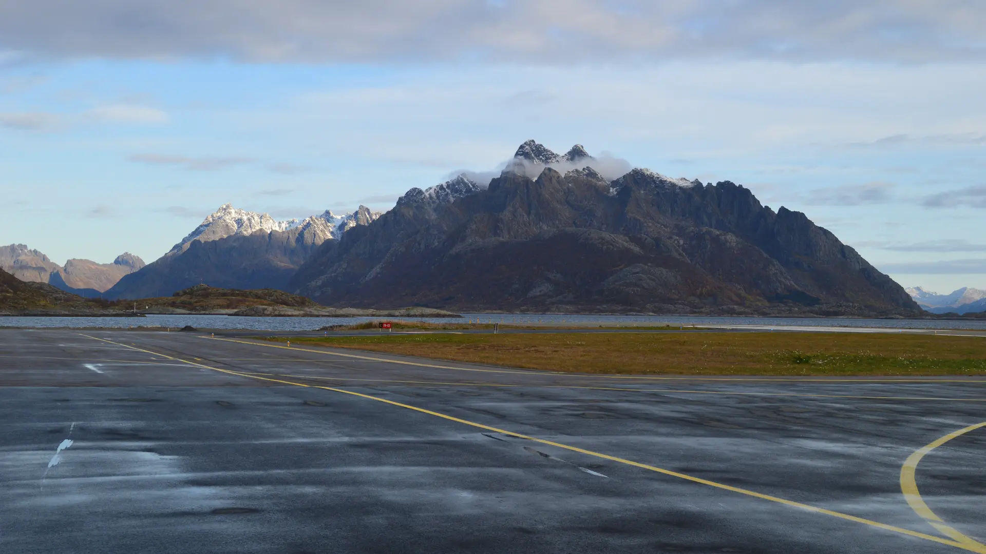
On the islands themselves, there are two airports: Leknes Airport (LKN), located roughly in the center of the archipelago, and Svolvær Airport (SVJ), located toward the eastern end. Both airports are served by direct regional flights year-round, primarily from Bodø and Tromsø. During the summer season, additional routes are added, with Oslo offering direct flights to both Leknes and Svolvær.
Bodø Airport (BOO) has year-round direct flights from several Norwegian cities and serves as the primary transfer point for onward regional flights to Leknes and Svolvær. Bodø is also a major ferry port, which makes it a natural hub for travelers who plan to combine flying with sea travel. Continuing from Bodø to Lofoten by car is possible, but it involves a long detour on the mainland of more than 400 kilometers, which typically takes more than seven hours.
Harstad/Narvik Airport, Evenes (EVE) plays a different role. It has year-round direct flights from several Norwegian cities, as well as international connections from Finland. The range of options expands significantly during the summer, with direct routes from major European airports. Unlike Bodø, Evenes does not offer onward flights to the airports in the Lofoten Islands. Travelers arriving via Evenes continue to Lofoten by rental car or public transport, with driving distances of roughly 170 kilometers to Svolvær and around 240 kilometers to Leknes. This makes Evenes a common choice for those who want to enter the islands by road.
Flight schedules in northern Norway are frequently adjusted and vary significantly by season. Routes that operate one year may not return the next, and frequencies can change between summer and winter. For this reason, it is always worth checking current schedules when planning a trip, especially if connections are tight or travel dates fall outside the main season.
Choosing where to fly in is less about proximity and more about how the rest of the journey is structured. Flying directly to Leknes or Svolvær minimizes overland travel but limits flexibility. Arriving via Bodø or Evenes opens up different combinations, depending on whether ferries, road travel, or a mix of both better suits the pace of the trip.
Ferries to the Lofoten Islands
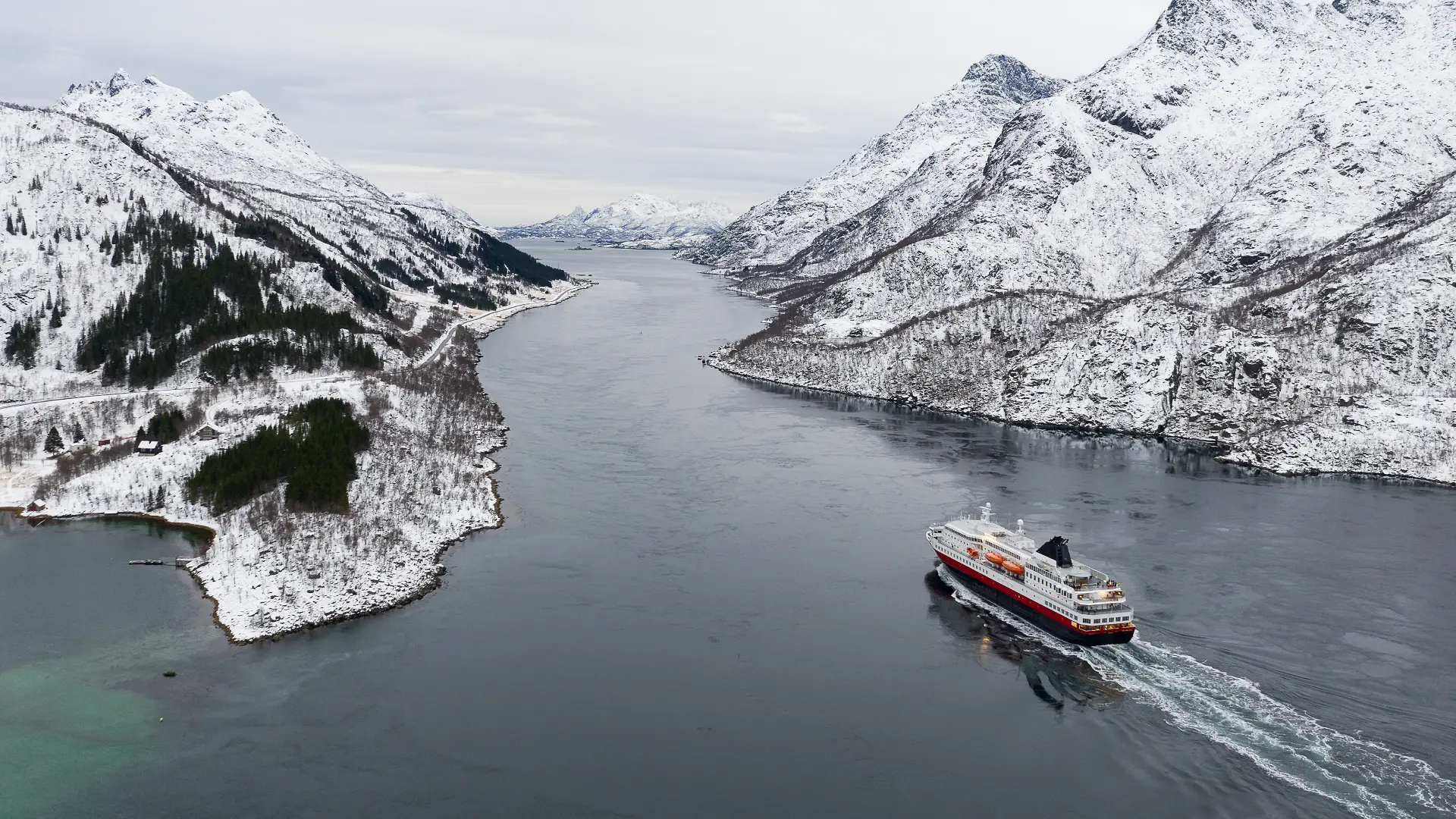
Ferries play an important role in travel to the Lofoten Islands, particularly for those arriving via the mainland by car or combining several modes of transport. While flying is the fastest option, ferries provide a practical alternative and, for many travelers, a more gradual way to enter the islands.
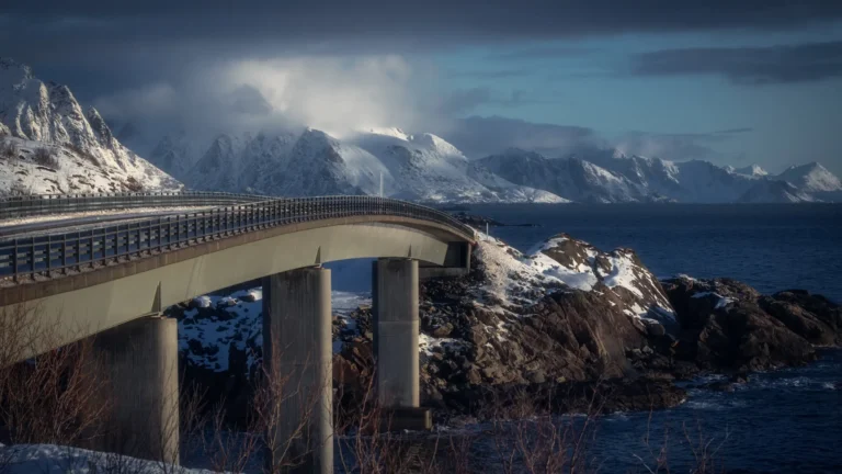
Several ferry routes connect Lofoten to the Norwegian mainland, with Bodø and the southern approaches being the most relevant entry points. The most direct connection is the Bodø–Moskenes ferry, which operates year-round and takes about 3.5 hours. Some sailings run directly, while others include stops at the outer islands of Værøy and Røst. This route is one of the main ways to bring a car into Lofoten by sea.
Further south, the Bognes–Lødingen ferry also operates year-round and forms part of the main road route, linking the mainland with the islands. During summer, an additional seasonal ferry runs between Skutvik and Svolvær, offering a shorter sea crossing into the eastern part of the archipelago.
In addition to car ferries, there are also passenger-only boats serving Lofoten. One of the most well-known is the Bodø–Svolvær express boat, which takes about 3.5 hours and is often chosen for its scenic route. These services do not carry vehicles and are best suited for travelers relying on public transport.
While ferries are an essential part of transport in northern Norway, capacity has become a growing issue in recent years. During the summer season, demand often exceeds availability, and sailings can fill up quickly, particularly on car-carrying routes. Arriving early and allowing flexibility is no longer optional during busy periods, as the number of vehicles and passengers often exceeds what the ferries were originally designed to handle.
Road Travel to the Lofoten Islands

Traveling to the Lofoten Islands by road can take different forms, depending on whether you arrive with a car or rely on public transport. Road travel usually begins on the mainland, either from Evenes Airport or from Bodø, and the choice between the two determines how the journey into the islands unfolds.
From Evenes Airport, road travel is direct. Travelers continue by rental car or public transport, following the main road west before crossing onto the islands. While distances are manageable, progress is often slower than expected due to traffic, weather, and road conditions.
From Bodø, road travel works differently. Although it is technically possible to drive from Bodø to Lofoten entirely by road, the route involves a long detour on the mainland and typically takes more than seven hours. For this reason, most travelers who rent a car in Bodø combine driving with a ferry crossing. This approach reduces overall driving time and makes Bodø a practical starting point for car-based travel in Lofoten.
Some travelers choose to arrive without a car and rely on public transport instead. One common approach is to take the express boat from Bodø to Svolvær and then continue by bus. This option avoids long drives and traveling with a car on ferries, but it limits flexibility and requires closer coordination with timetables, especially when traveling beyond the larger towns.
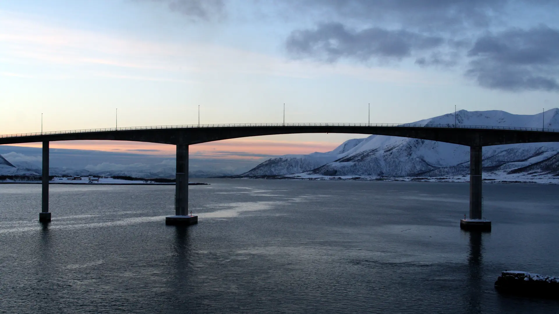
Within the Lofoten Islands, public transport connects the six municipalities through a network of local and regional bus routes. Buses operate both within individual municipalities and between major settlements across the archipelago. In addition, a small number of short ferry crossings between islands are integrated into the public transport system and function as part of regular travel routes.
Whether traveling by rental car, bus, or a combination of both, realistic pacing and the ability to adjust plans matter more than covering ground quickly.
In Summary
Getting to the Lofoten Islands involves more than choosing a route on a map. Flights, ferries, and road travel all work, but they shape the trip in different ways. Some options save time but reduce flexibility, while others take longer and allow for a slower, more gradual transition into the islands.
Where you arrive and how you continue onward influence daily rhythm, access to different areas, and how much room there is to adjust plans along the way. Weather, season, and capacity all play a role, often in ways that are hard to predict in advance.
Understanding these trade-offs early makes it easier to plan activities realistically once on the islands. Rather than optimizing for speed, most trips benefit from choosing a transport approach that matches the pace you want your stay in Lofoten to have.